DIPAS
The digital participation system for transparent and low-threshold citizen participation. DIPAS makes it possible to present planning processes comprehensibly and to collect and evaluate feedback directly on interactive maps—online, on mobile devices, or on site.
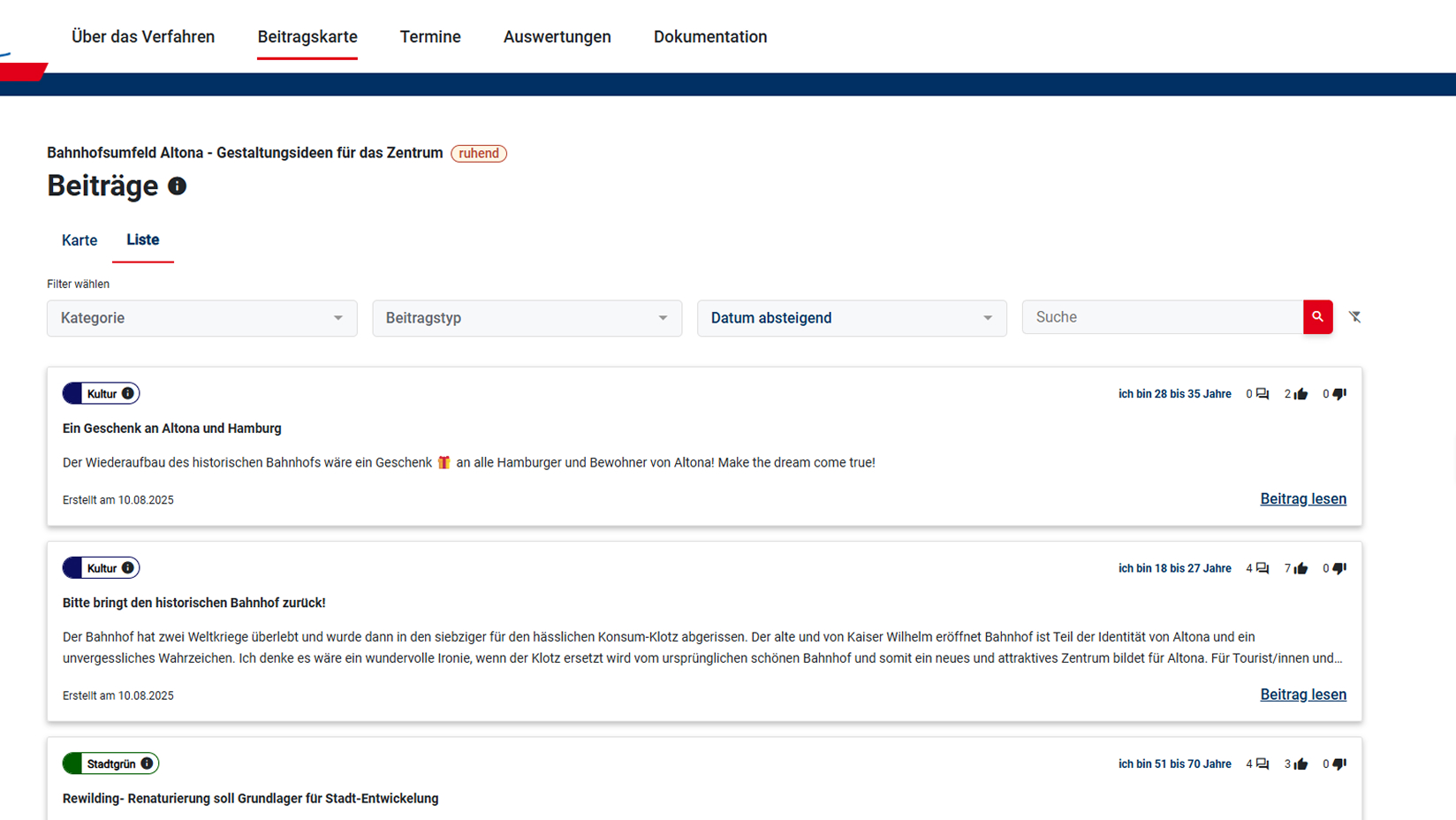
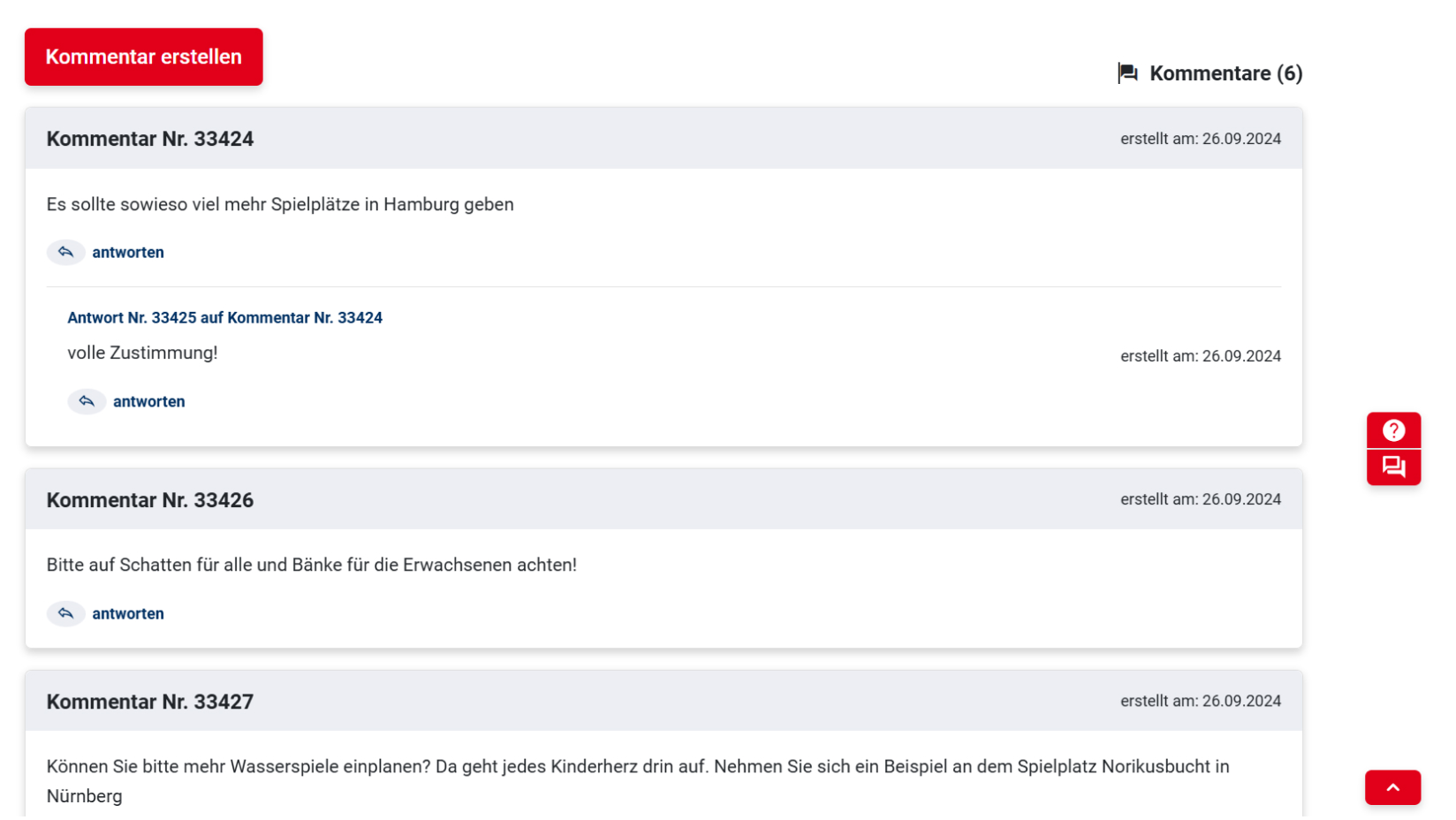
Collecting ideas
DIPAS_ideas
With DIPAS, citizens can submit their ideas, comments, suggestions, and criticism regarding the planning project directly on an interactive map.
All contributions are publicly visible and can be commented on or rated by others.
In addition, DIPAS offers the option of integrating surveys using the proven Limesurvey tool. This gives project managers the opportunity to ask citizens closed questions in addition to their open-ended contributions and comments, e.g., about their relationship to the project area, usage behavior, or (anonymously) about themselves.
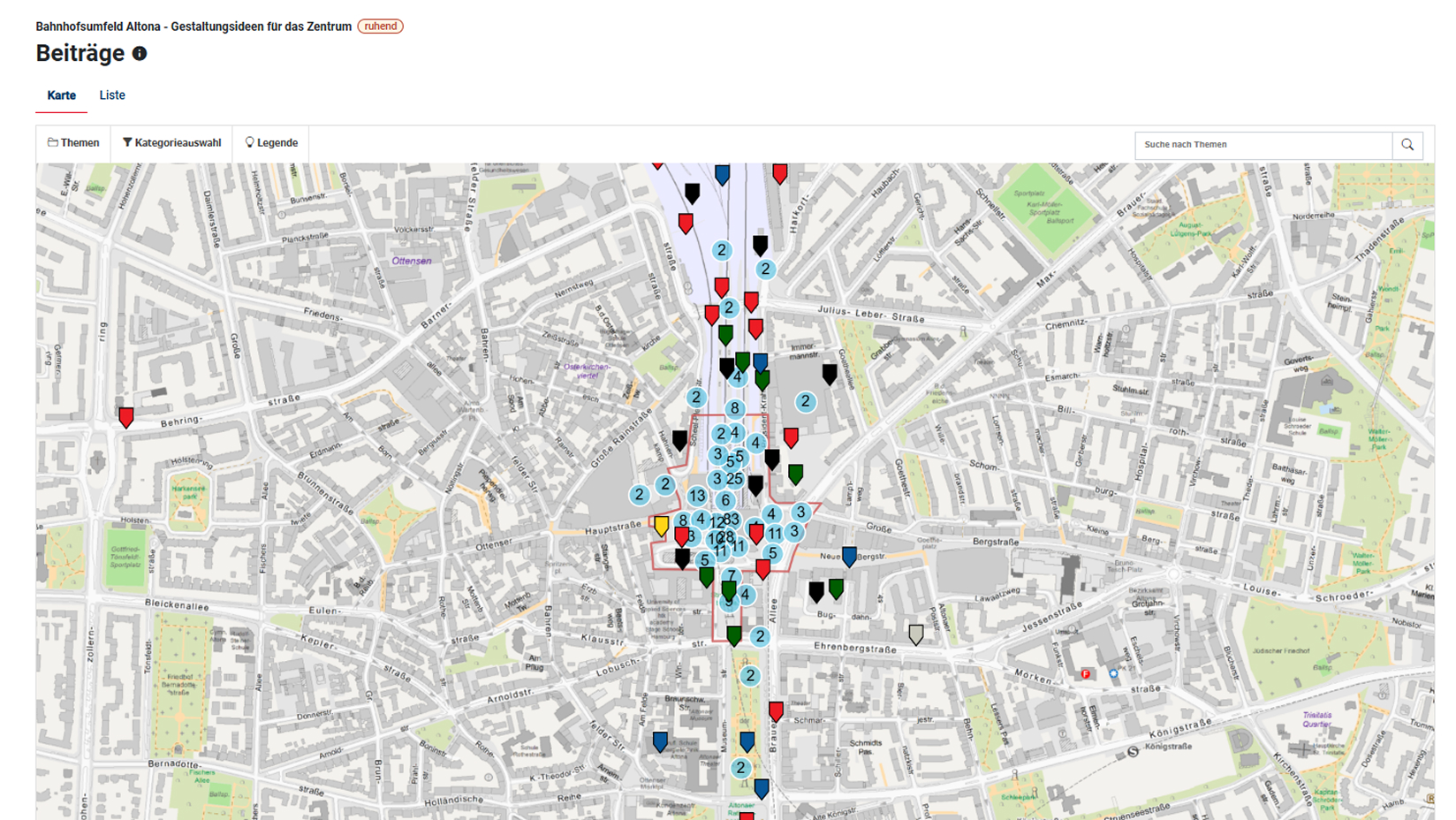
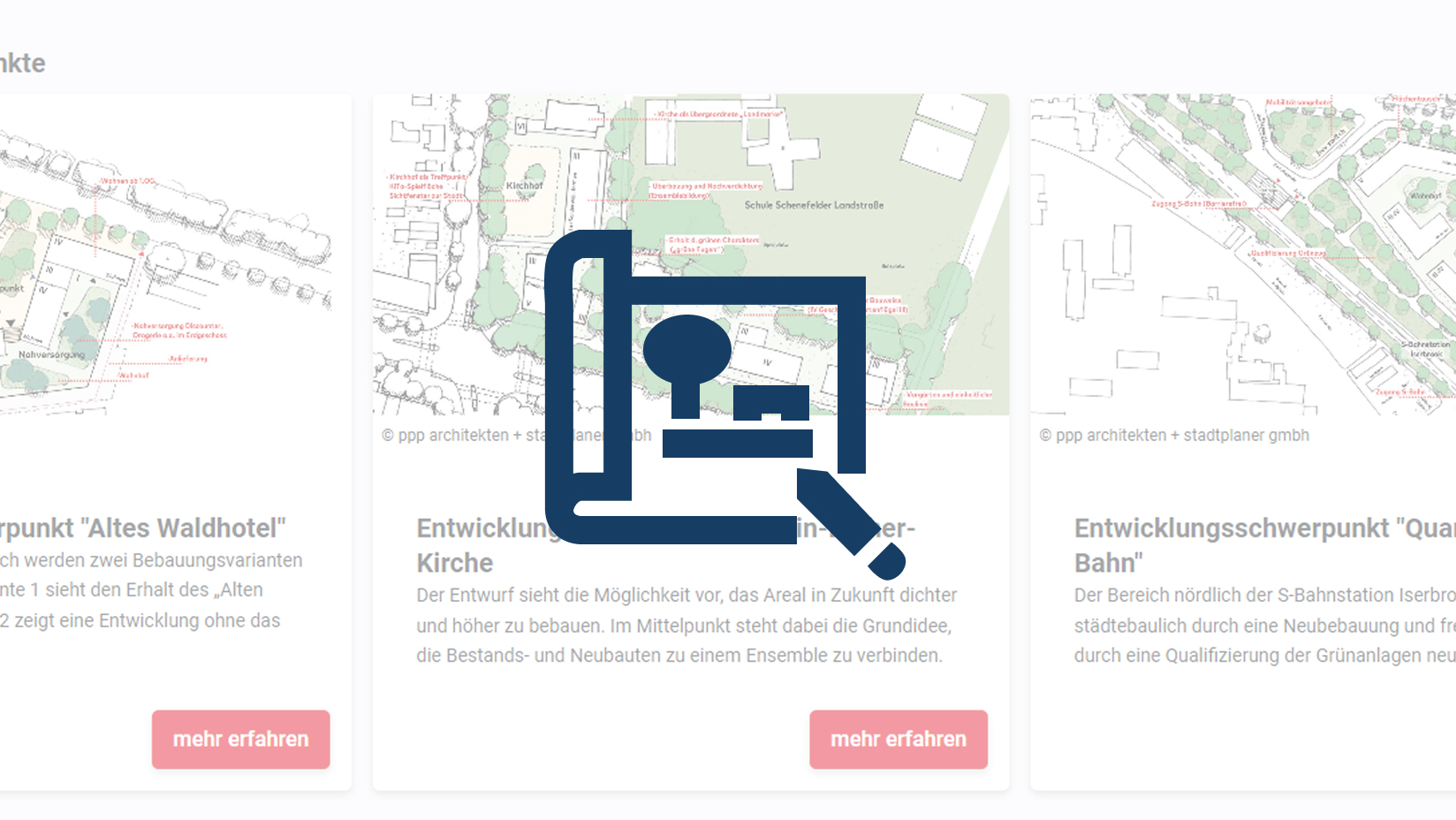
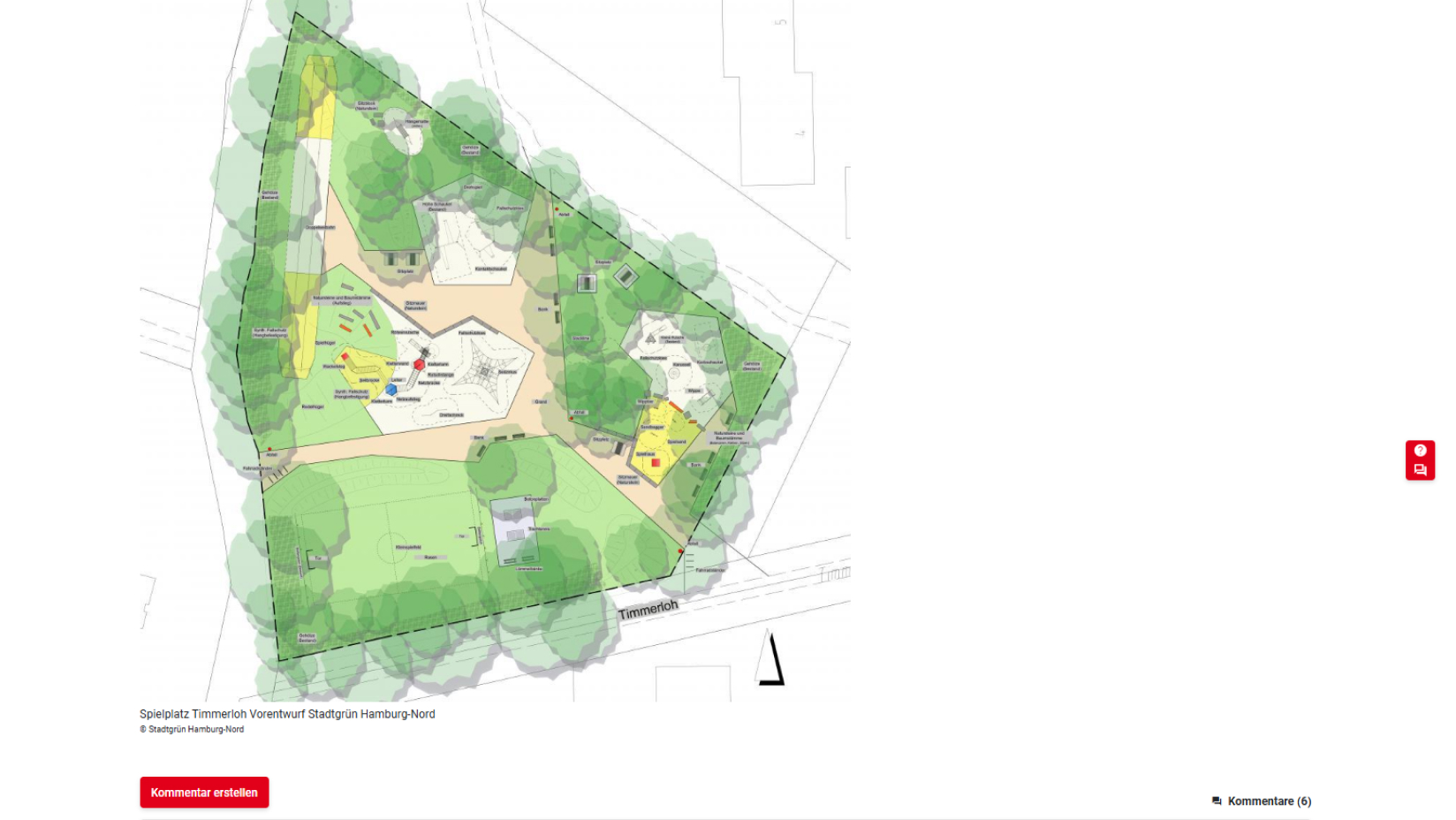
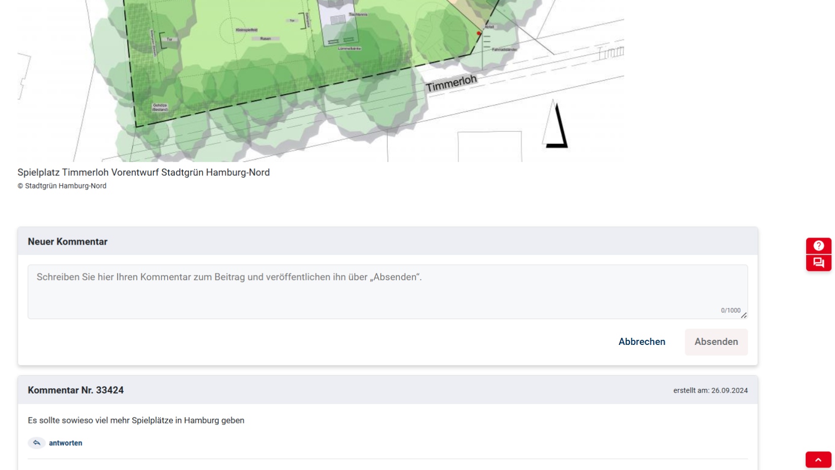
Discussing plans
DIPAS_plans
With DIPAS, for example urban development concepts or different infrastructure planning options can be compared side by side. Citizens can then easily comment on the proposals, which consist of plans, texts, or images.
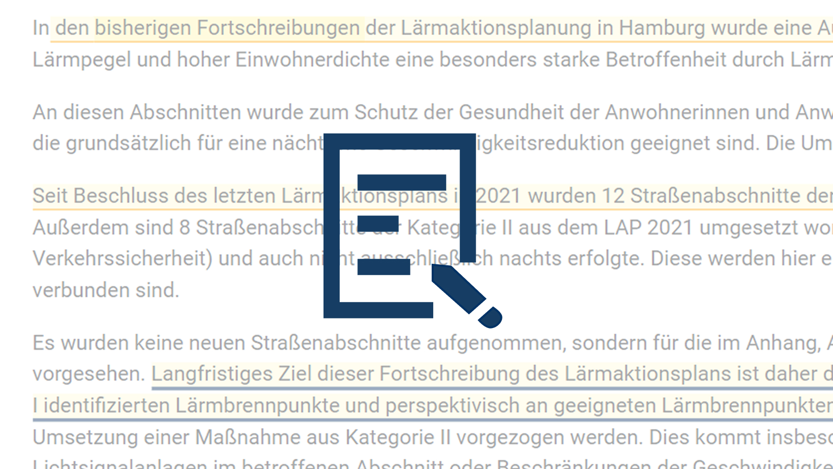
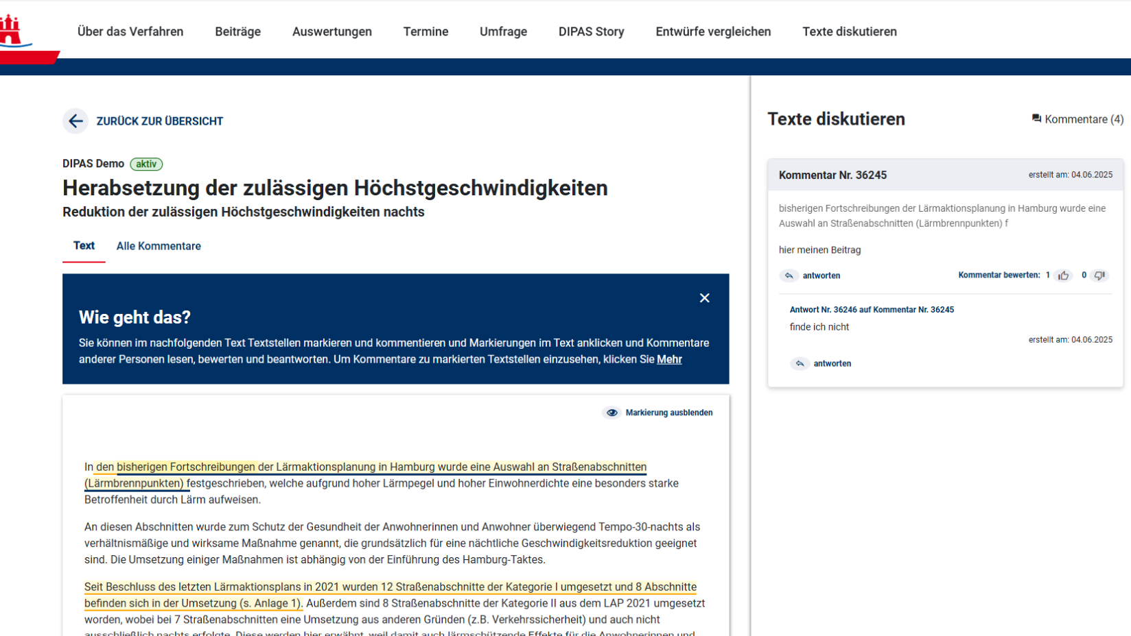
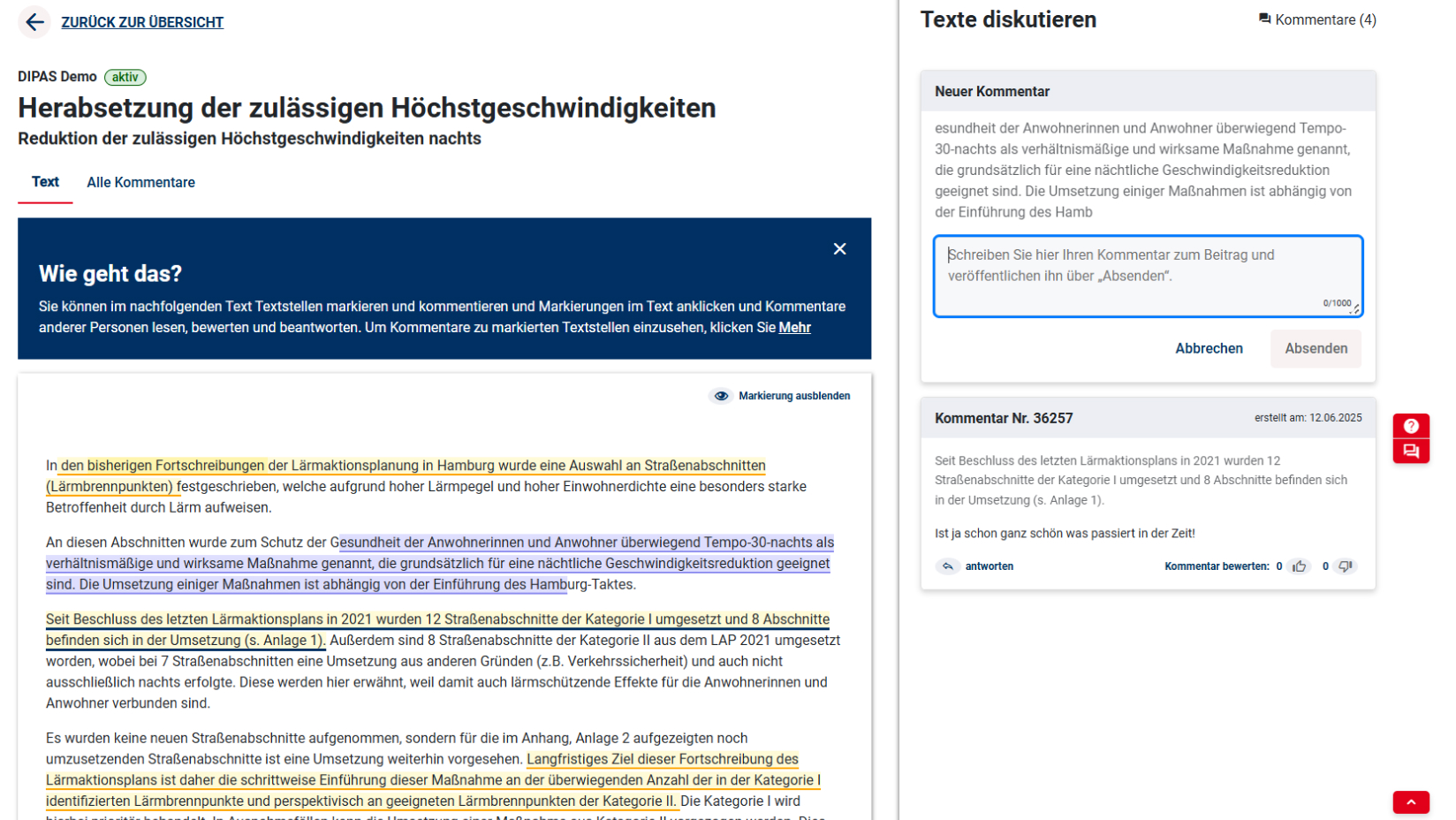
Commenting on texts
DIPAS_text
In addition to spatial participation, DIPAS can also be used to contribute to the formulation of texts (strategy papers, concepts, draft laws, etc.). Text passages can be highlighted and commented on. These comments can in turn be read, evaluated, and responded to by other people.


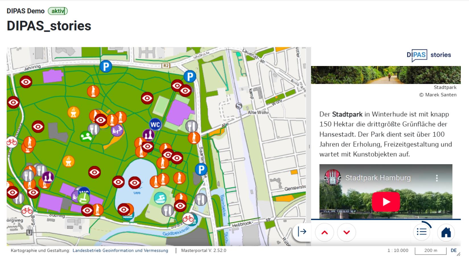
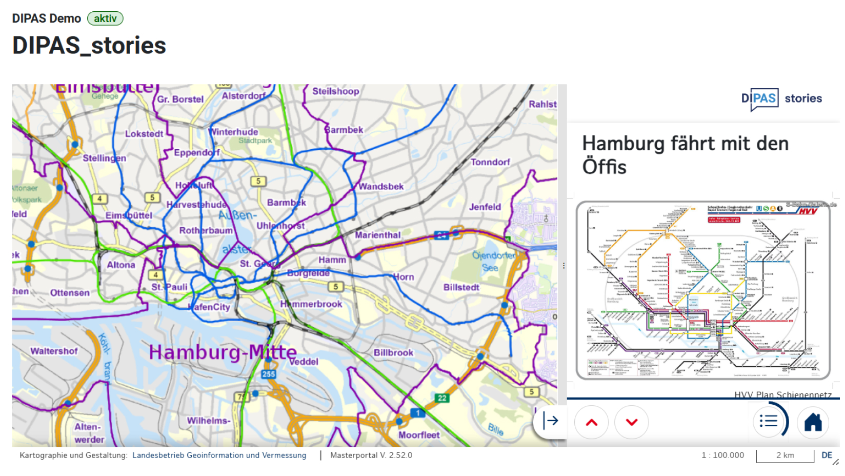
Telling stories with maps
DIPAS_stories
DIPAS_stories can be used to illustrate even complex plans or urban development frameworks.
Maps, geodata, and 3D models are linked with text, images, and videos to create location-based stories that users can then explore by scrolling.
Storytelling makes information easier to access and planning projects more tangible and comprehensible for everyone.
Try it out here (German) Learn more
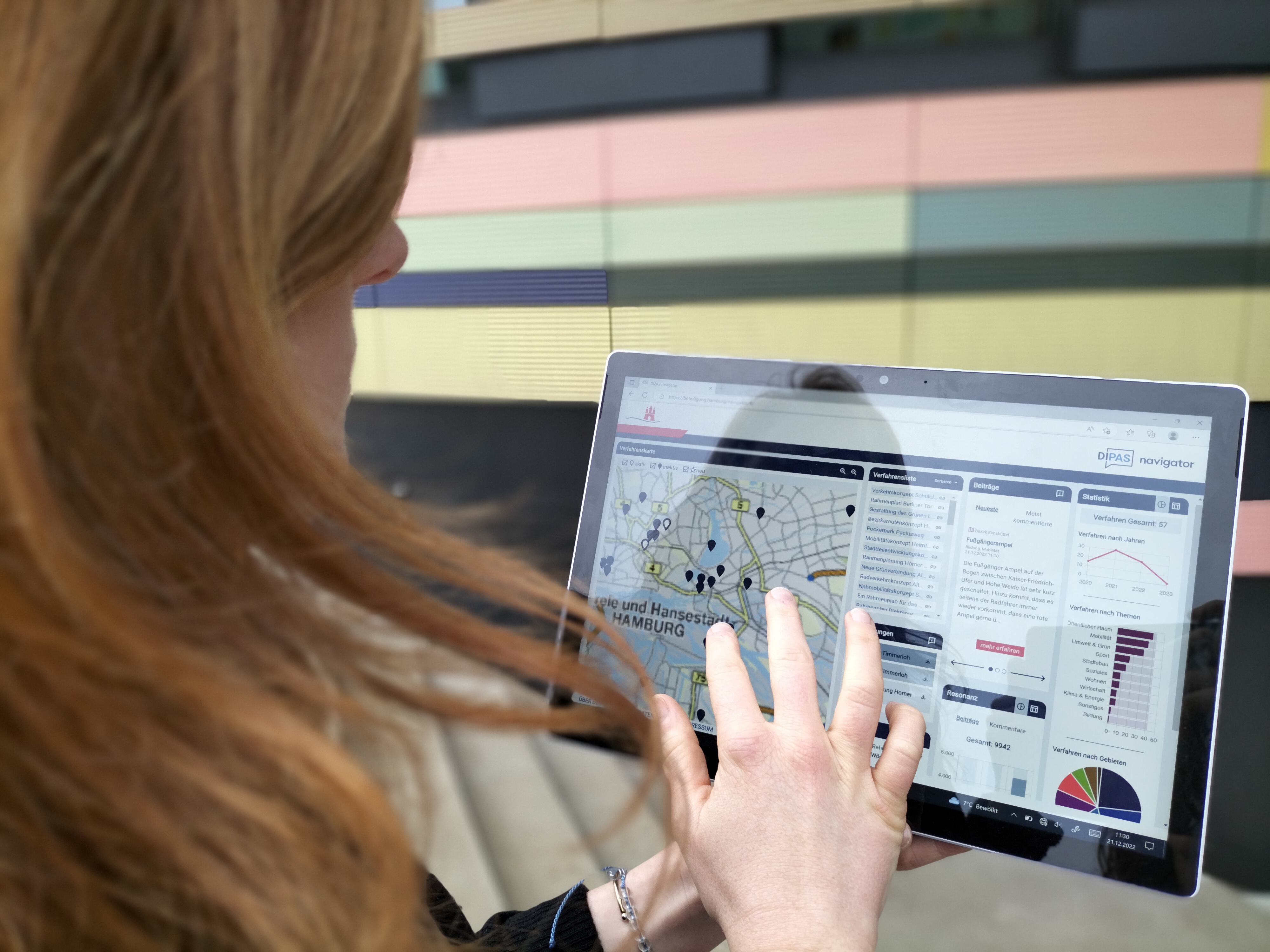
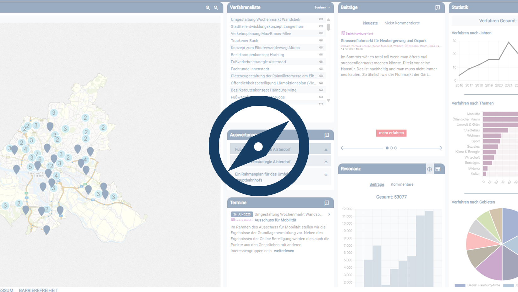
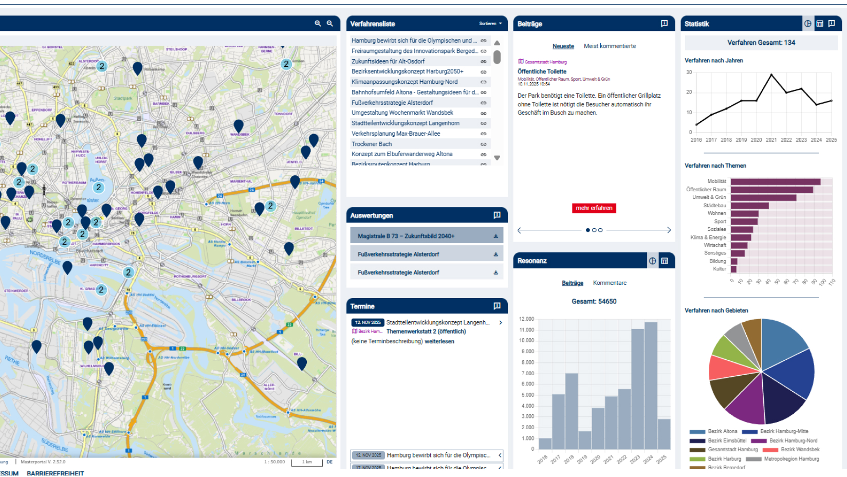
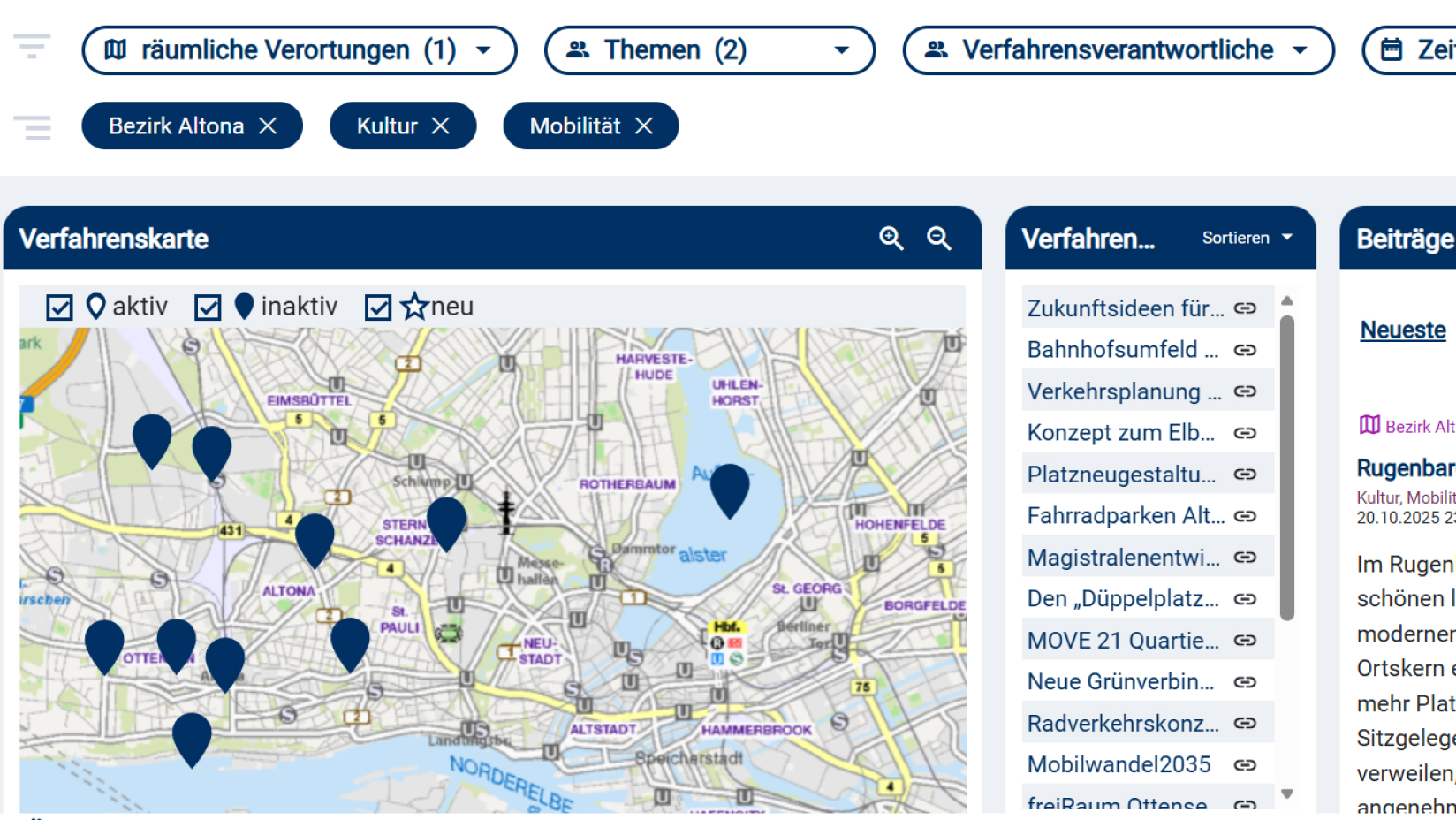
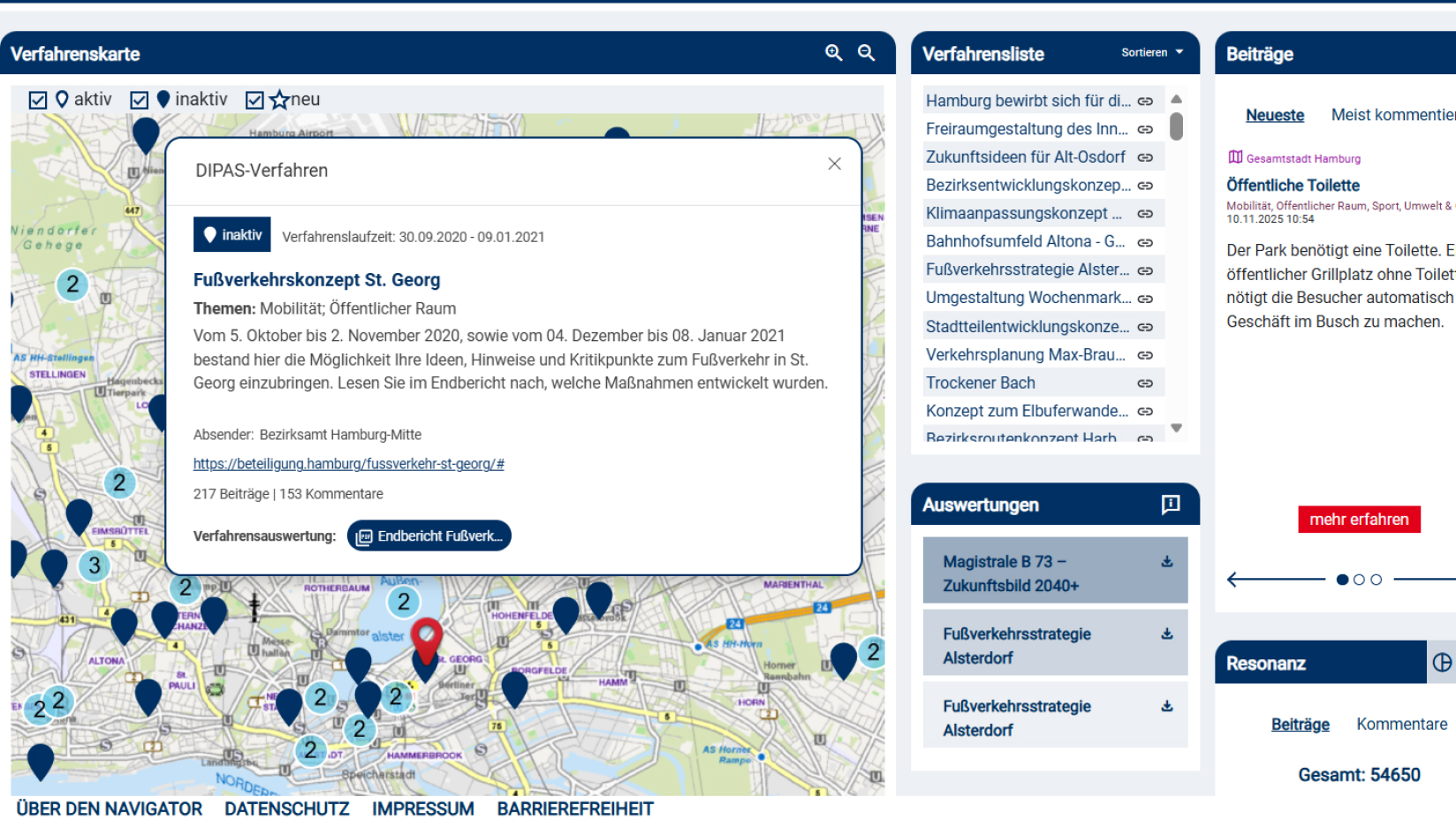
Getting an overview of all processes
DIPAS_navigator
The DIPAS_navigator brings together all of a city's digital participation processes in one place. It shows where, when, and on what topics citizen participation has taken place, including current opportunities to get involved and local events.
With interactive maps, key figures, and statistics, the navigator offers orientation and transparency regarding participation activities across the entire city.
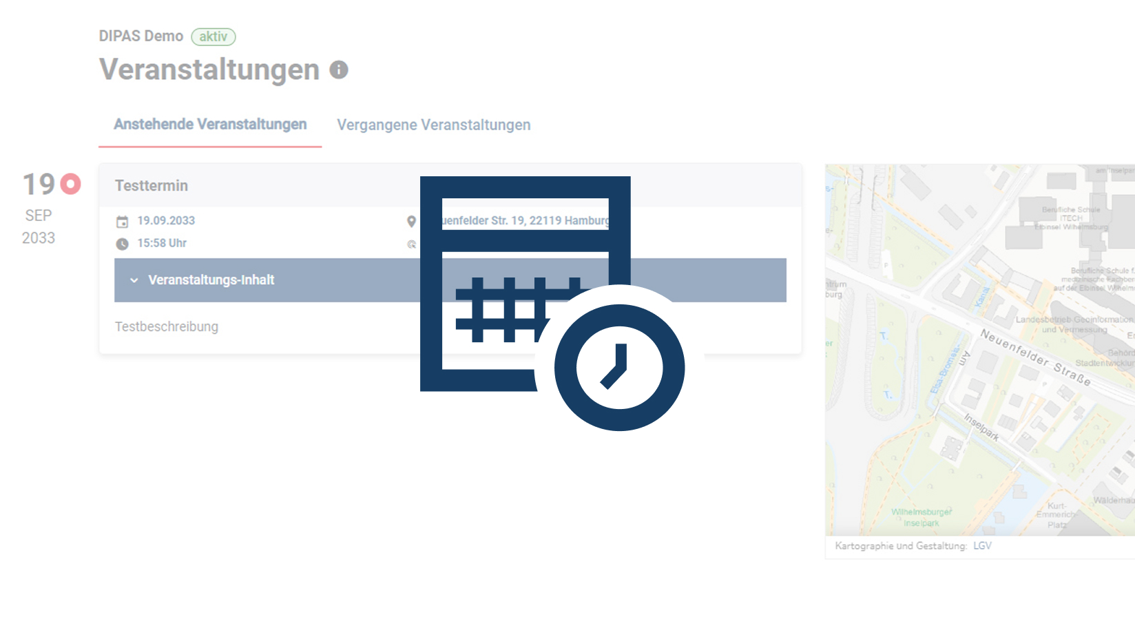
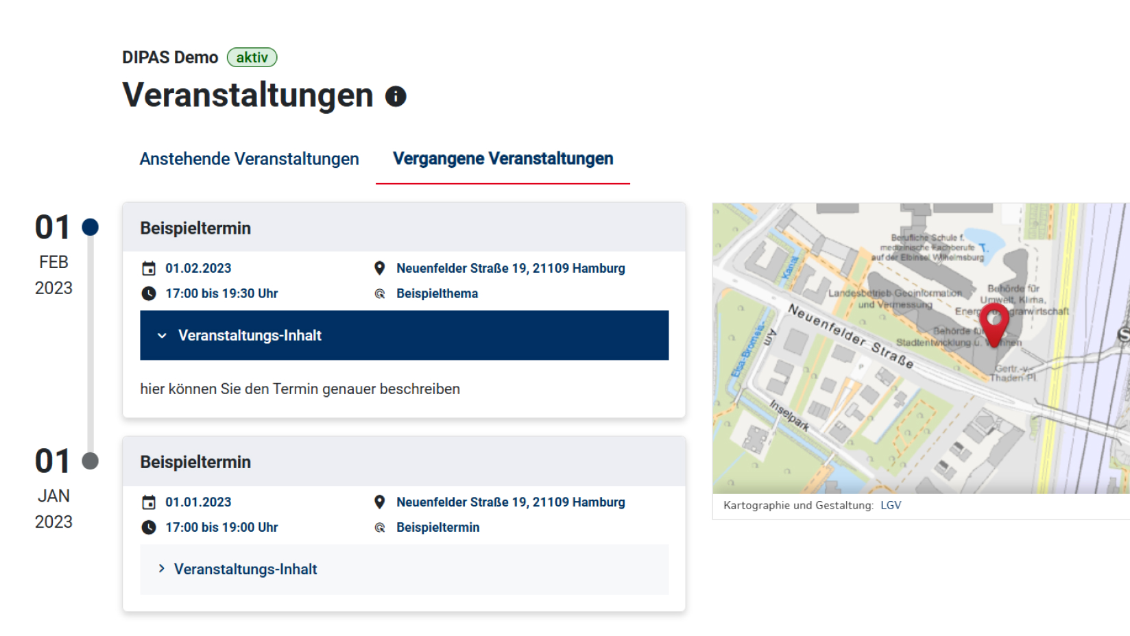
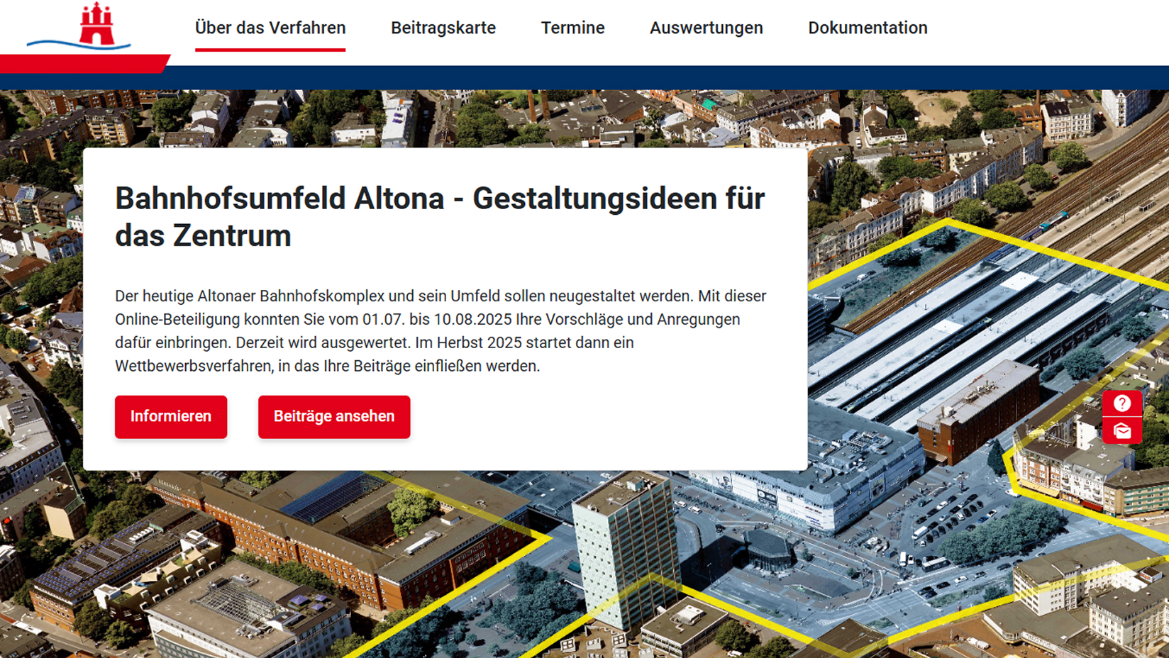
Setting up a project website
DIPAS_info
If required, DIPAS can take on all the functions of a project website, including a schedule preview, media library (plans, videos, documents, etc.), integration of newsletters, and contact details.
Live evaluations also provide everyone with a transparent overview of the current status of participation.
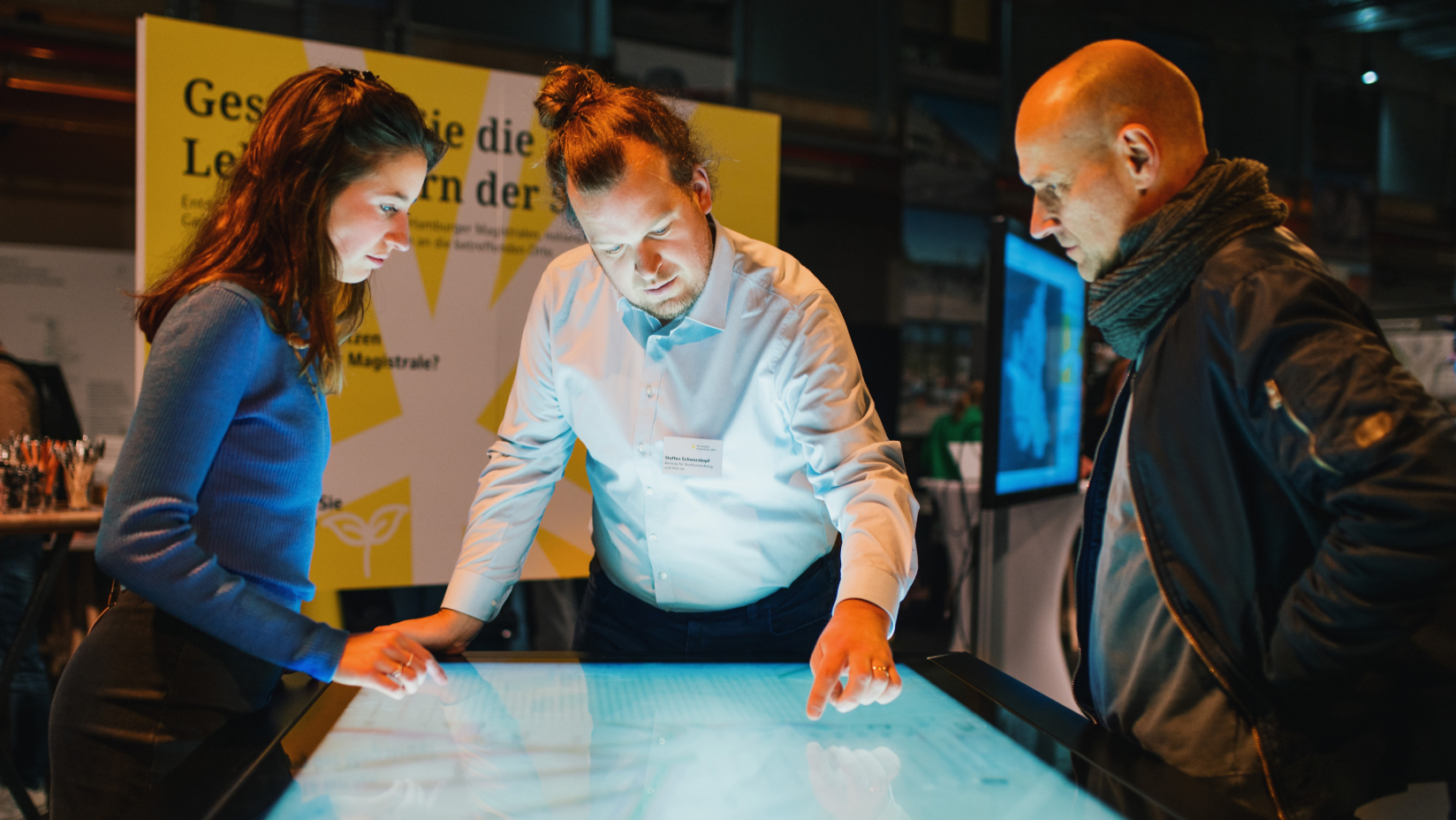
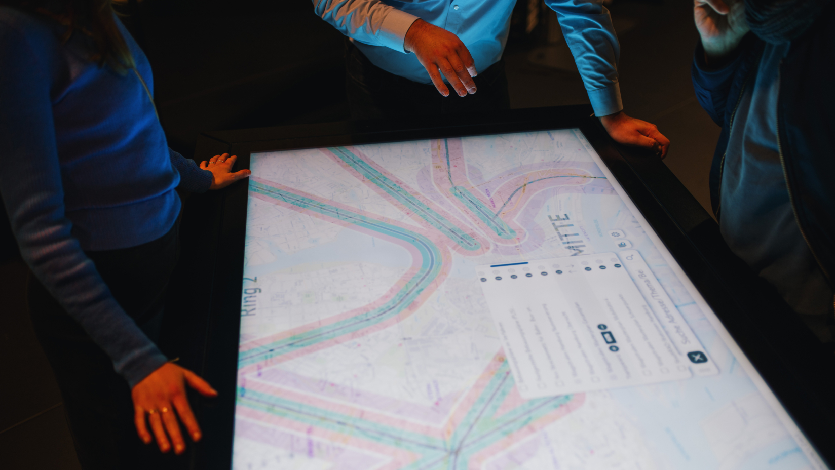
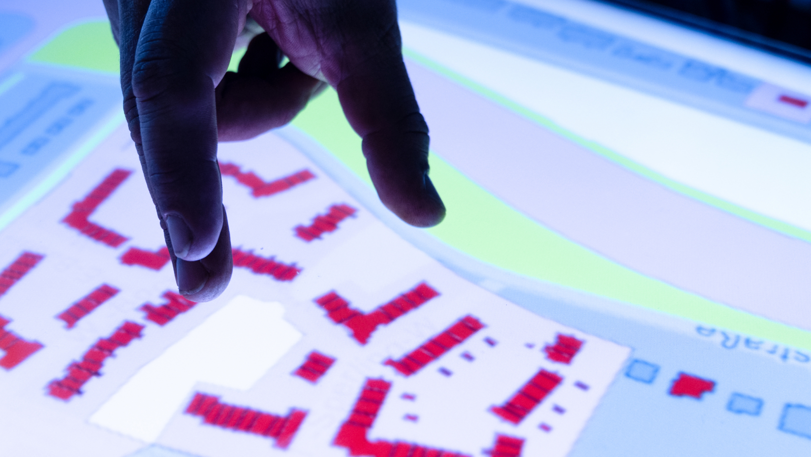
Digital participation on site
DIPAS_touchtable
In addition to online participation, DIPAS also offers an “onsite” component for participation in face-to-face events (workshops, information events, etc.): The interactive interface of DIPAS can be used on a mobile multi-touch table and provides an overview of the project area with all available information and geodata. Plans can be explored and discussed together with experts. This creates a well-founded, dialogue-oriented exchange on an eye-to-eye basis.
All contributions, both from events and online participation, are recorded in a shared database for seamless and efficient representation in the process and subsequent evaluation.

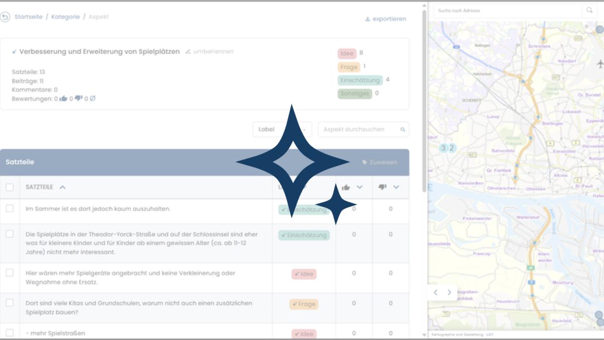
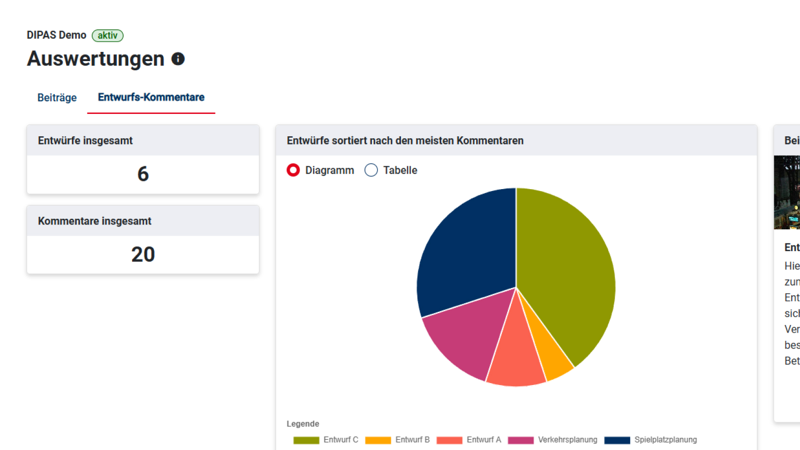
From 2026: AI-based evaluation
DIPAS_analytics
In the future (from mid-2026), AI will be used to support the evaluation process by pre-structuring feedback, enabling faster and better understanding of the content.
During the participation process, an AI-supported moderation assistant will help participants keep track of what is happening.
After the process, AI will help sort, analyze, and clearly visualize all feedback.
More Questions?
Feel free to contact us to discuss your planned project—free of charge and with no obligation: